 Xeocatalogo
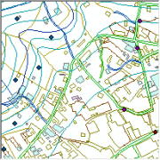
Servizo Web de Mapas (WMS) no que publica a Base Topográfica de Galicia 1:5000
Servizo Web de Mapas (WMS) no que publican as capas da Base Topográfica de Galicia 1:5000 realizada a partir de restitución fotogramétrica dos voos realizados entre os anos 1990 e 2000. Posteriormente actualizáronse as capas planimétricas utilizando ortofotografía do ano 2003. Esta base cartográfica recolle información sobre:
- Altimetría
- Hidrografía
- Construccións e Edificacións
- Vías de comunicación e infraestructuras
- Parcelario aparente e coberturas forestais
- Toponimia
- Límites administrativos
Simple
Identification info
- Date ( Revision )
- 2013-01-01
Point of contact
CONSELLERÍA DE MEDIO AMBIENTE, TERRITORIO E INFRAESTRUTURAS - XUNTA DE GALICIA
-
Instituto de Estudos do Territorio - IET
()
+34 981 541 757
http://www.cmati.xunta.es/
San Lázaro, s/n
,
Santiago de Compostela
,
A Coruña
,
15703
,
España
+34 981 541 755
+34 981 541 757
http://www.cmati.xunta.es/
- INSPIRE_SpatialDataServicesClassification
-
- Servicio de acceso a mapas
- infoMapAccessService
- Servicio de gestión de modelos/información geográficos
- infoManagementService
- WebServicesSpecification
-
- 1.3.0
- WMS
- OGC
- European Territorial Units ( Place )
-
- ESPAÑA
- Galicia
- GEMET - INSPIRE themes, version 1.0 ( Theme )
-
- Elevaciones
- GEMET - INSPIRE themes, version 1.0 ( Theme )
-
- Hidrografía
- GEMET - INSPIRE themes, version 1.0 ( Theme )
-
- Edificios
- GEMET - INSPIRE themes, version 1.0 ( Theme )
-
- Redes de transporte
- GEMET - INSPIRE themes, version 1.0 ( Theme )
-
- Parcelas catastrales
- GEMET - INSPIRE themes, version 1.0 ( Theme )
-
- Cubierta terrestre
- GEMET - INSPIRE themes, version 1.0 ( Theme )
-
- Nombres geográficos
- GEMET - INSPIRE themes, version 1.0 ( Theme )
-
- Unidades administrativas
- Use limitation
- Non se aplican condicións
- Access constraints
- Other restrictions
- Other constraints
- Permítese calquer uso se se menciona a autoría do IET
- Service Type
- view
N
S
E
W
))
- Coupling Type
- Tight
Contains Operations
- Operation Name
- GetCapabilities
- Distributed Computing Platforms
- Web services
Contains Operations
- Operation Name
- GetMap
- Distributed Computing Platforms
- Web services
Contains Operations
- Operation Name
- GetFeatureInfo
- Distributed Computing Platforms
- Web services
- Distribution format
-
- Hierarchy level
- Service
- Other
- Servicio web de datos espaciales. Servicio de visualización
Conformance result
- Date ( Publication )
- 2009-10-19
- Explanation
- Consultar el reglamento mencionado
- Pass
- Yes
Conformance result
- Date ( Publication )
- 2010-12-08
- Explanation
- Consultar el reglamento mencionado
- Pass
- No
Conformance result
- Date ( Publication )
- 2008-12-04
- Explanation
- Consultar el reglamento mencionado
- Pass
- Yes
- File identifier
- spaietwms_cartografia_basica_2014 XML
- Metadata language
- Galiciangl
- Hierarchy level
- Service
- Date stamp
- 2020-11-05T13:34:24
- Metadata standard name
- NEM-S: ISO 19115 / ISO 19119 + Reglamento (CE) Nº 1205/2008 de Inspire
- Metadata standard version
- 1.0
Point of contact
CONSELLERÍA DE MEDIO AMBIENTE, TERRITORIO E INFRAESTRUTURAS - XUNTA DE GALICIA
-
Instituto de Estudos do Territorio - IET
()
+34 981 541 757
http://www.cmati.xunta.es/
San Lázaro, s/n
,
Santiago de Compostela
,
A Coruña
,
15703
,
España
+34 981 541 755
+34 981 541 757
http://www.cmati.xunta.es/
Overviews
thumbnail
Spatial extent
N
S
E
W
Provided by

Associated resources
Not available